
What is a citizen media organization doing in the forest? In recent years, the Kambisa! has partnered with the Minamba Research Farm, a research farm located in Zambia’s unique miombo forest, which holds a wealth of local knowledge. During the “Heritage Heroes” film project, participants explored their connection to this natural foundation of their heritage; while developing a forest monitoring tool, we sought methods that would allow forest dwellers to test for themselves which forestry practices work best: those of their ancestors, those of the English traders, or those of the postcolonial superpowers? Our collective quest to find productive uses for our cultural heritage sometimes yields unexpected lessons. You can read more about this in this series.
Some time ago, the Umoja Climate Fund—supported by the Dutch band BLØF—helped us create a manual that enabled forest users to measure for themselves the benefits of different forest management methods; not only in terms of financial gain, but also, for example, in terms of soil improvement, water management, biodiversity, and labor savings. In addition to pre-colonial knowledge, the guide included various agroforestry methods to test, such as the construction of infiltration ditches. Indirectly, the guide also provided instructions on how to protect and propagate endangered tree species, and what benefits this could bring to forest management. This way, we hoped not only to provide forest users with greater income security, but also to better protect the endangered biodiversity of their forest.
App?
After more than a year of intensive research and design, however, it became clear that the target group didn’t know what to do with a booklet containing more than 60 pages of forms to fill out. No matter how user-friendly the measurement methods were, if people didn’t even open the booklet, it wasn’t going to be used. It was clear that we had to come up with a different format that would appeal to them.
First, we drew up a plan for an app to be installed on a phone that people would receive in exchange for their data. We thought this would kill many birds with one stone: 100 rural households would gain access to a phone and a small solar panel, and we would learn how to built apps that can be a new form of media. The Minamba Research Farm would gain access to data that would allow it to monitor a much larger portion of the unique miombo forest. It would then be able to purchase more certified sustainable forest products, which in turn might encourage forest farmers to stop commercial logging. Financially, however, we couldn’t make it work.
Open-Air Museum
Fortunately, part of the University of Local Knowledge—an old patch of miombo bush adjacent to the Minamba Research Farm—lies along a path frequently used by forest visitors walking toward the village of Chilonga. In recent years, it has become clear that this area of land is difficult to protect from fire: many people almost see it as their civic duty to throw a match into the dry undergrowth. This method of rejuvenating the forest has become so ingrained that we actually need many more “No Burning” signs to stop it.
The practice isn’t entirely unjustified, however: by burning away the undergrowth while it’s still relatively short, you can prevent the fire from reaching the tree crowns later in the dry season. Those kinds of late-season fires cause much more damage. Our request to neither cut down trees nor set fires is therefore only safe if we simultaneously ensure there are proper firebreaks and a soil that retains sufficient moisture.
Infiltration Ditches
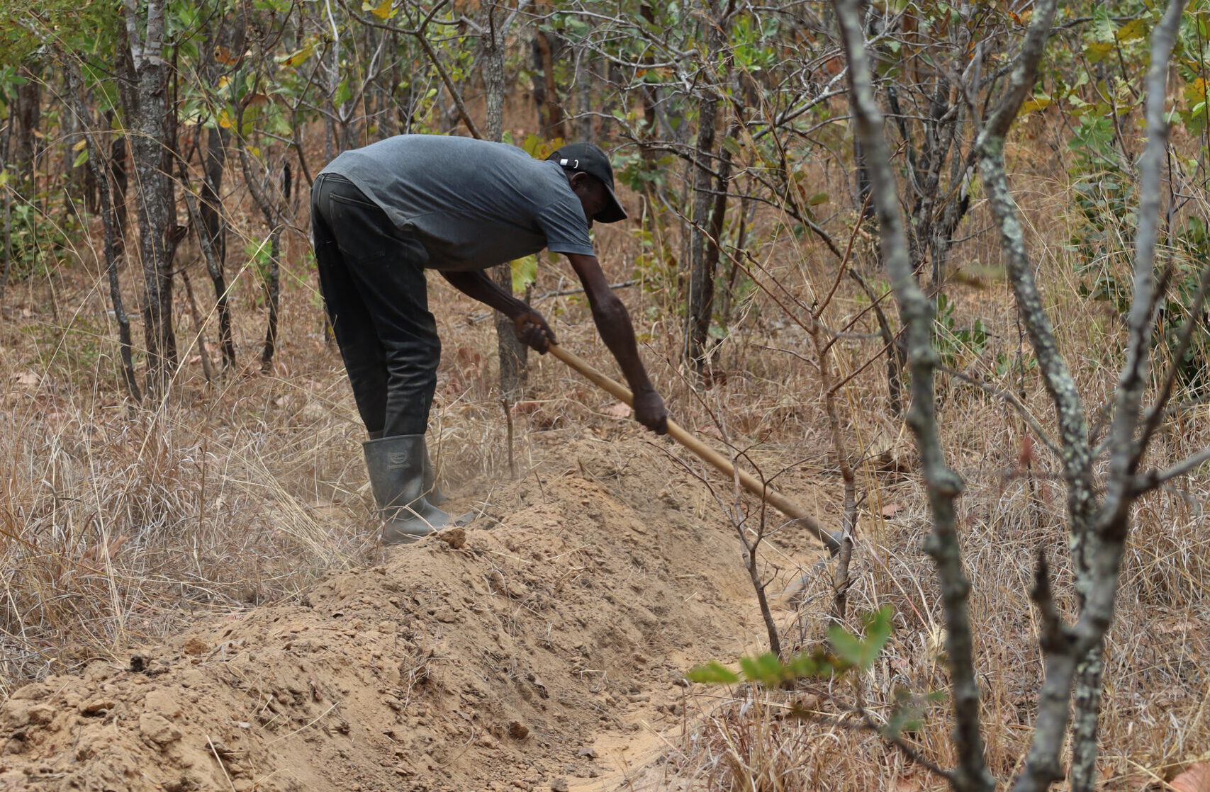
To achieve this, we have installed infiltration ditches (“swales”) along the path to prevent erosion. During the rainy season, up to one meter of rainfall can fall in just a few months. The ditches are designed to prevent this water from washing away the rich topsoil and to slow the flow of water, allowing it to seep into the soil. On the valley side of the swales, we’re creating a raised bed where we’re combining deep-rooted crops like millet with fire-resistant crops like cassava and aloe, as well as native nitrogen-fixing plants like perennial pigeon peas.
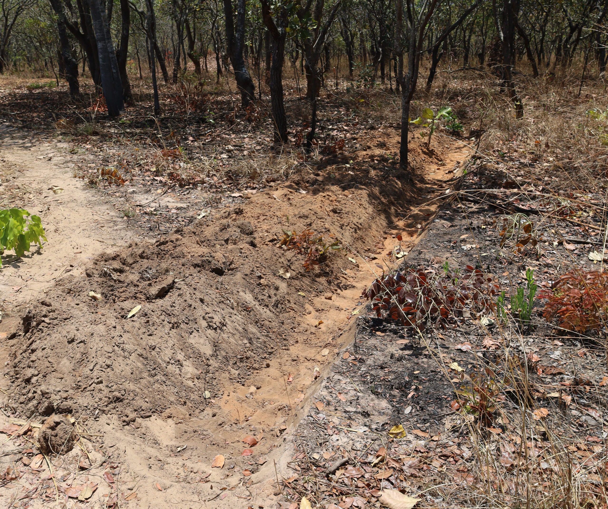
One of the newly constructed “swales”—an infiltration ditch designed to help improve soil fertility and retain more water. On the left is the footpath to Chilonga. (Photo: Roeli Andrea, October 2026)
So far, the infiltration swales have proven to be an unexpected success: aside from the purpose for which we built them, the trail users are very pleased because they expect the swales to help keep the trail itself in good condition for longer. They expect that the swales—which in many cases divert water away from the path—will prevent their route from becoming impassable during the rainy season. In the coming months, we’ll see whether those hopes actually come true, or whether we’ll need to build even more swales to achieve that.
Meanwhile, the land managers are relieved that the boundaries of the plot are now more clearly marked, which should make their job as site guards easier.
You read the first part about the process in which, in October 2026, we transformed the University of Local Knowledge’s plot into a de facto open-air museum. In part two, you’ll read more about the construction of the first mud wall; part three explains the first tree posts.